
CONCRE Building Intelligence™
See the building before the scaffolding goes up.
Drone-based visual and thermal data acquisition, digital façade mapping and structured defect identification — organized so engineers, owners and restoration teams work from the same picture of the building.
What it produces
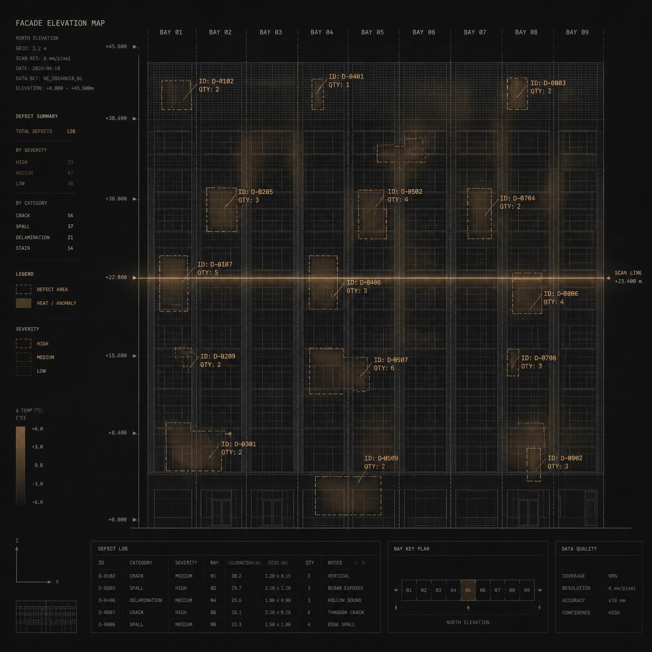
A building described in coordinates, IDs and quantities.
Restoration decisions usually rely on scattered photographs and narrative descriptions. Building Intelligence replaces that with a structured record that can be measured, compared and audited.
Illustrative visualization. Drone and thermal data indicate conditions warranting further investigation. It does not diagnose structural defects and does not prove the presence of water intrusion.
Workflow
Capture to quantification, with human and engineering review built in.
No step in this sequence replaces judgement. Automated pre-screening only sorts what a person looks at first.
- 01
Capture
Repeatable drone flight plan over each elevation, balcony line, roof edge and garage structure.
- 02
Digital façade
Imagery assembled into an elevation grid with coordinates for every bay and level.
- 03
Pre-screening
Visual and thermal anomalies are flagged as areas warranting a closer look — never as findings.
- 04
Human review
CONCRE technicians confirm, discard or reclassify each flag against the imagery.
- 05
Targeted detail
Close-range capture, sounding or access is directed only where it is warranted.
- 06
Engineering review
The Engineer of Record evaluates, diagnoses and specifies. CONCRE supplies the record, not the conclusion.
- 07
Quantification
Confirmed items convert into measured quantities by repair type, each tied to its location ID.
Capabilities
What the survey delivers.
Data acquisition
Drone-based visual and thermal capture of façades, balconies, roof edges and garage structures, flown to a repeatable elevation plan rather than ad-hoc photography.
Digital façade mapping
Each elevation is drawn as a grid. Every observation lands on a coordinate, so the north elevation of level four means the same thing to the engineer, the owner and the field crew.
Defect identification
Observations receive a structured ID — elevation, level, bay, type and sequence — that follows the item from survey through repair and close-out.
Photo traceability
Before, during and after photographs attach to the defect ID, producing an evidence chain for pay applications, reserve studies and association records.
Quantity tracking
Mapped observations convert into measured quantities that can be compared against field-verified quantities as the work progresses.
Engineer support
Deliverables are structured to support the Engineer of Record's own evaluation and documents — not to substitute for them.
Roles and responsibility
CONCRE observes, maps and quantifies. The Florida PE evaluates, diagnoses and specifies.
The Engineer of Record remains responsible for diagnosis, design, sealed documents and all engineering decisions. CONCRE supports that work with methodology, mapping, estimating, QA/QC, field execution and documentation, following ACI 562 and ICRI practices in general terms.